Explore the World with Google Earth Engine
 Follow
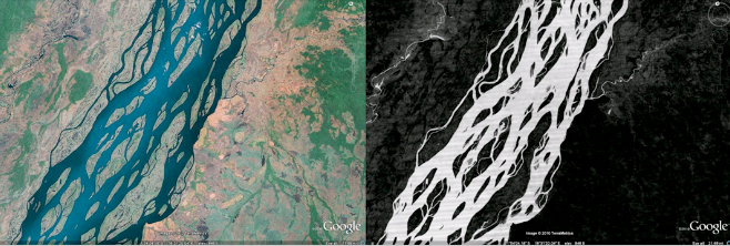
Last week marked the 40th anniversary of the Landsat satellite program (http://landsat.gsfc.nasa.gov/) —now the longest-running continuous acquisition of satellite images of the Earth’s surface. The entire Landsat7 imagery archives are publicly accessible through Google Earth Engine (http://goo.gl/fjTZL), with a new and improved featured gallery, which includes zoomable time-lapse videos and a beautiful new interface: http://earthengine.google.org/#intro!
Google Earth Engine enables scientists to use our extensive computing infrastructure—the Google cloud—to analyze an unprecedented amount of satellite imagery and data. The new gallery includes what may be the largest video frame ever created. At 1.78 terapixels, if you tried to view all at once, it would take 18 football fields’ worth of computer screens laid side-by-side.
 Google Earth Engine technology has already been used to compute the forested areas of Mexico (http://earthengine.google.org/#intro/MexicoTreeCover), identify deforestation in the Amazon (Monitoring Forests From the Ground to the Cloud) and map roadless areas of the world (http://earthengine.google.org/#intro/Roadless1km).
We look forward to seeing the full potential of the Landsat archives revealed, as Google Earth Engine and other tools enable non-professionals to explore this valuable trove of data.